-
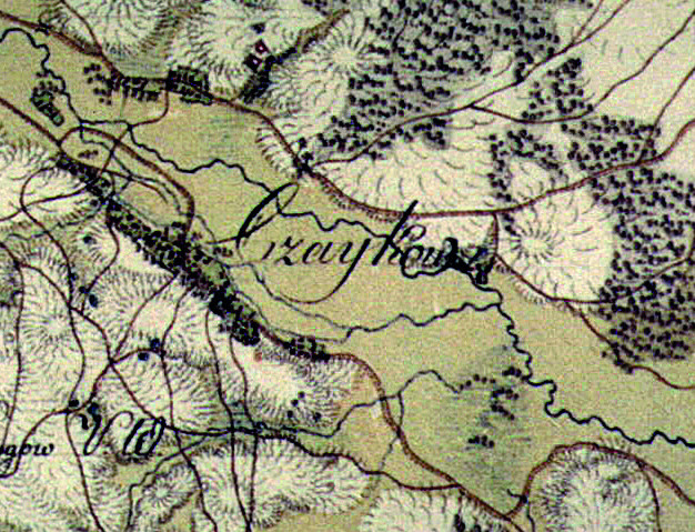
Czajków Południowy
 Czajków Południowy (South Czajków) is a village in the Municipality of Staszów, in Świętokrzyskie Province. It is located on the St. James Małopolska Route connecting Sandomierz and Tyniec. This route is a modern equivalent of the medieval road leading to Santiago de Compostela in Spain.
There is a river (Kacanka) close by Czajków Południowy, and across that river – at a distance of about 1.2 km – lies Czajków Północny (North Czajków), its twin village.
-
Czernica
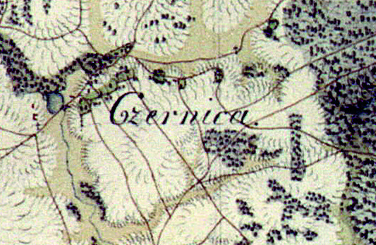 Czernica is a village surrounded by woods rich in mushrooms, berries and blackberries. It currenty houses about 200 residents. Czernica belongs to the parish of Kurozwęki, wherein lies the Assumption of Mary and St. Augustine Church.
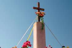
Czernica itself is also rich in places of religious worship. A large cross was placed near the road leading to Czernica by pilgrims traveling from Stalowa Wola to Częstochowa. Each year, on the 6th of August, an outdoors mass for pilgrims is held by that cross.
-
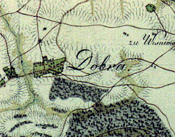
Dobra
 A village located along the route from Staszów to Bogoria. It used to be divided into two distinct localities: Dobra farmlands and Dobra village.
In 1820, 140 people were living in Dobra. Later, 35 households with 325 residents were recorded in 1827. By the end of the 19th century, Dobra had 7 brick houses, 21 wooden ones, a distillery, brick factory, quarry, and rich peat and gypsum reserves in its soil. In 1880 most of the farmlands were dissolved, and in time were transformed into a group of hamlets: Ogrody, Zagumnie, Ściegna, Kliny, Pocieszka. Those hamlets currently comprise the village.
-
Czajków Północny
 The name Czajków comes from "Czajka", who was the chief of the tribe that settled at Kacanka Valley in ancient times.
Czajków Północny (North Czajków) can be found in historic documents dating back as far as the 15th century – it used to be a royal hamlet belonging to the Sandomierz District (along with others hamlets: Smerdyna and Wiązownica). However, archeaological discoveries (ancient pottery items) have proven that prehistoric humans were living in the Czajków area as early as the Neolithic era.
-
Gaj Koniemłocki
 Gaj Koniemłocki ("the Koniemłoty Grove") is a small village surrounded by lush, vibrant forests. The village's location makes it a very attractive tourist spot for those who prefer to spend their free time in a peaceful and quiet retreat. The villagers' main source of income is agriculture, mostly vegetable farming; tomatoes are particularly commonly cultivated. The locals also deal in construction and repairs.
.
.
-
Grzybów
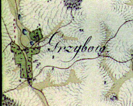 Grzybów has a rich history which is well known to local archaeologists. Megalithic tombs dated at 4500 years old were excavated here, along with a crematory cemetery from the Roman Empire period (1st-2nd century), where unique ancient breastpins were unearthed.
In modern times, Grzybów became known for implementing experimental methods of sulfur mining. In 1963 this project of sulfur exploitation – through means of underground melting – was inaugurated at the Grzybów-Gacki area. American experts of the time had stated that the project was futile and doomed to fail. Contrary to their assessment, on June 1st of 1966 the "yellow gold" of sulfur gushed from the Grzybów mines. It was a pivotal moment for the region and for the development of sulfur industry in Poland.
.
-
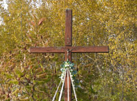
Jasień
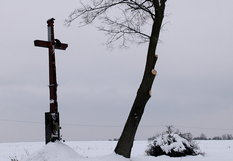
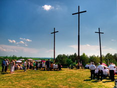 Jasień is a picturesque village located nearby the Czarna valley. Three large, wooden crosses standing at Kobryniowa Hill are the distinctive spot of Jasień's scenery; they are often referred to as the "Golgotha of Jasień". Initial crosses were built in the interwar period by Ignacy Kobryń, who moved to Jasień from the vicinity of Częstochowa. Those crosses were destroyed during World War II, then rebuilt during early 1990s and ceremoniously consecrated in 1994.
In 1827 Jasień had 30 houses and 191 villagers.
The village has access to springwater considered to be very healthy by locals. The picturesque surroundings, the closeness of Czarna River and Chańcza bay are conductive to farm tourism in Jasień.
-
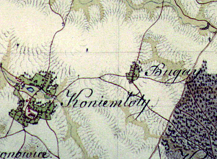
Koniemłoty
 Koniemłoty is a village located in Połaniec Basin, about 5 km to the south-west of Staszów. Koniemłoty is one of the oldest villages in Staszów County.
Koniemłoty initially belonged to the Holy Cross Benedictine Order, under the decree of king Bolesław Chrobry, who visited the village in 1246. In 1270 king Bolesław V the Chaste protected Koniemłoty – along with other property of the Benedictine Order – from war expeditions marauding through Poland. In 1351 king Casimir III the Great transferred Koniemłoty over to German jurisdiction.
In 1527 Koniemłoty became property of Łaski noble family, heirs of Staszów. That change of ownership was officially approved on January 5th of 1527 during Kraków Sejm.
-
Kopanina
 After the dissolution of Dobra farmsteads in 1880 several hamlets were formed in their place; one of them was Kopanina.
Nowadays, Kopanina is a small village located near a woodland area that is rich in edible mushrooms, including porcini, parasol, yellow bolet and honey fungus.
By the end of 1999 there were 122 residents in Kopanina, in 2006 – 124 people, in 2012 – 123 people, and towards the end of 2015 there were 117 residents living there.
-
Krzczonowice
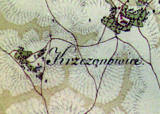 Krzczonowice is a village located in Świętokrzyskie Province, Staszowski County, Municipality of Staszów. It has a distinct name, pronouncing which is sure to provide foreign visitors with a challenge! Krzczonowice's history dates back to at least the 14th century, when it was first mentioned in written documents – as "Krzczonów" – in 1325. In 1827, there were 14 households and 60 residents living in the village. During World War II villagers were evicted by the Russian army, whose artillery battalion was garrisoned there. Remains of tank and artillery shelters can still be found in the nearby woods.
.
.
-
Krzywołęcz
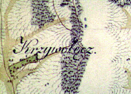 Krzywołęcz is a moderately old village; unfortunately, locating historical records of its founding proved to be very difficult. In the 1770s the village was owned by castellan of Żarnów, Jan Sienieński. In 1827 there were 4 houses with 76 villagers there. Nowadays there is a glassworks in the village which employs most of Krzywołęcz's residents. There is also a monument dedicated to the memory of Home Army soldiers in the nearby "Grzybów" forester's lodge. Krzywołęcz belongs to Koniemłoty Roman-Catholic parish. The village is divided into three parts: Krzywołęcz (central part), Kolonia Podlesie Krzywołęcz ("Woodland Colony"), and Stara Wieś ("Old Village").
.
-
Kurozwęki
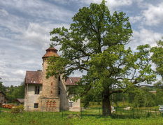
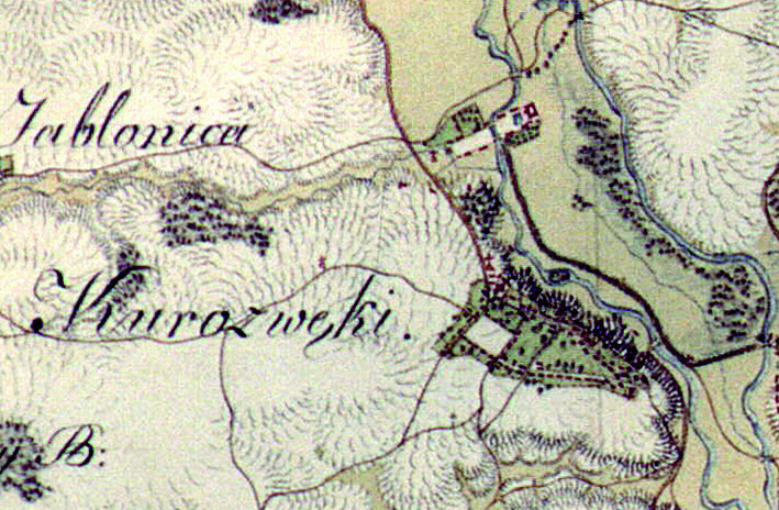 One of the largest villages in the Municipality of Staszów, Kurozwęki is located by the Czarna Staszowska river, 7 km to the north-west from Staszów. Records of its existence date back to the 13th century. In the 14th century, Dobiesław of Kurozwęki built a wood-and-stone palace as the new home for his family. Initially the palace was a stronghold – it served a defensive purpose. It was also one of the very first brick castles in Poland. Centuries have shaped the palace into its current form. Kurozwęki received its town charter in the 15th century. They were property of the Kurozwęcki noble family, and later: the Lanckoroński, Sołtyk and Popiel families.
-
Lenartowice
 Lenartowice is a small village belonging to the parish of Koniemłoty. A village by the name of "Lenartów Most" ("Lenartów Bridge") was mentioned in documents of the Łysa Góra cloister from 1442. Jan Długosz, famous medieval Polish chronicler, lists two villages with similar names: Lenartów Most and Lenartowice. In 1508 Lenartowice were annexed into many goods of Jan Bochotnicki. Later, the village was seemingly abandoned by the Łysa Góra cloister; however it is also possible that it retained some amount of influence, presumably in a tavern by the village bridge.
-
Łaziska
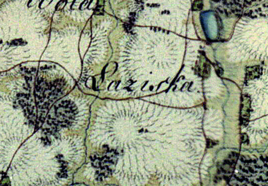 Łaziska is a small village which was founded at the so-called "Łazy" – old forest pathways, leading to glades with soil suitable for cultivation. The village takes its name from those trails.
Łaziska were mentioned in documents from the 17th century. 19th century documents state that there were 9 houses and 95 residents in the village at the time. In 1929, there were 19 households with 112 villagers.
Łaziska had belonged to the parish of Bogoria for several centuries. In the 1830s the village was property of Moszyński family.
-
Łukawica
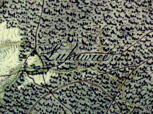 Łukawica lies on the St. James Małopolska Route connecting Sandomierz and Tyniec, which is a modern equivalent of the medieval road leading to Santiago de Compostela.
Łukawica is a relatively new village, its origins date back only to the first half of 19th century. The village's name was most likely derived from Łukawski family, who were its first owners. Another theory claims that the name comes from enfranchisement decrees called "ukaz". Those acts gave peasants legal holding of farmlands. Many so-called "landless" farmers were given their own land thanks to those "ukaz" decrees.
-
Mostki
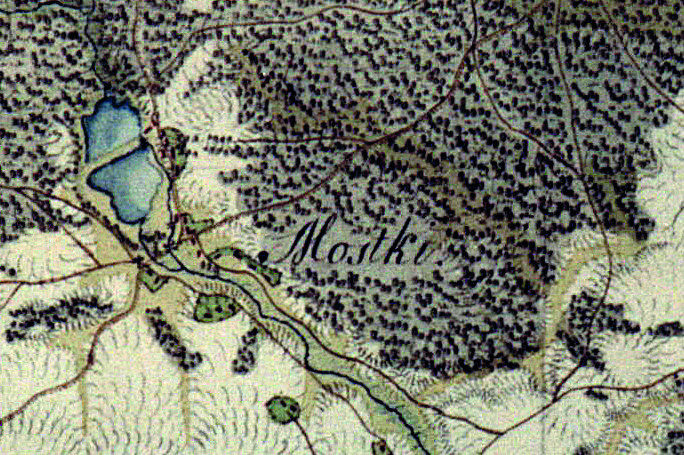 A village located on the Staszów-Opatów route. Its name means "little bridges" and it's probably derived from the bridge on Kacanka river in the village.
Earliest written mentions of Mostki can be found in documents from the 17th century; it beloged to Krzysztof Bogoria Podłęski at the time, the founder of nearby town Bogoria. Mostki has always been a very economically active village, thanks to its several manufacturing facilities. Mostki used to be divided into several parts: Mostki watermill, Mostki colonies, Mostki paper mill and the main village. It used to belong to Wiśniowa commune at the time.
-
Niemścice
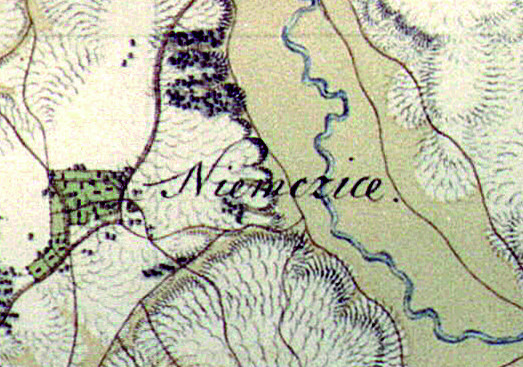 A village in the Municipality of Staszów. It was first mentioned by medieval chronicler Jan Długosz as "Nyemsczice". By the 16th century the name had transformed into "Niemsczice". The village's name comes from a given name – Niemsta. After the 16th century it was briefly called "Niemście-Zaraś", which derives from the Polish word "zaraza" meaning "epidemic" – referencing a local outbreak. Understandably, that version of the name did not last long and it was quickly transformed into its current form: Niemścice.
In 1827 Niemścice had 9 households, with 71 people residing there. It was part of Łubnice goods.
-
Oględów
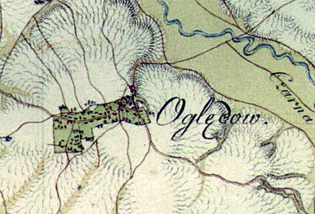 In his chronicles, professor Piekosiński claims that the name "Oględów" comes from the name of its founder – Oględ.
Historical analysis suggests there were some wooden houses present at today's Oględów location as early as 10th or 11th century.
In 1252, Bolesław V the Chaste convened a senate rally in Oględów. A similar rally took place once again, in 1256. In 1357 the quarrel over borders between Staszów and Kurozwęki was settled. Numerous meetings of wealthy people – castellans, provincial governors – were held at the Oględów court during Medieval times. There was also a castle, a surrounding borough, an administrative center, and also the Oględów water mill. There was a quarrel in 1417 about the ownership of Oględów between its potential heirs.
-
Poddębowiec
 A village in the Municipality of Staszów. In 1880, after the Dobra farmlands dissolution, a group of hamlets was created in their place – Poddębowiec was one of them. In time, it transformed into a bigger village. During the 1975-1998 period, Poddębowiec belonged to Tarnobrzeskie Province. The village is located near a lush forest, rich in mushrooms and wild berries.
.
.
-
Podmaleniec
 Podmaleniec, like Poddębowiec, was also formerly a part the Dobra farmlands. According to one of the village's oldest residents – Marianna Jońca, born in 1918 – Podmaleniec was divided into five distinct sections: Podmaleniec, Zagumnie, Ścięgna, Ogrody, Kąty.
Before World War I, Podmaleniec was part of the Wiśniowa gathering of localities, and was referred to as "Nowa Dobra". It was at that time councillor from Maleniec Jan Kos proposed that the village's name should be changed to Podmaleniec. During World War II villagers of Podmaleniec were exiled multiple times to Pliskowola and Czajków regions, due to the danger posed by battles taking place nearby.
-
Ponik
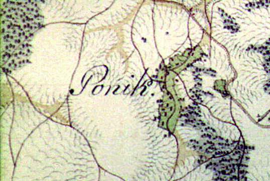 A small village near Kurozwęki whose name comes from a small creek flowing through its center. The Ponik creek disappears underground in Bełch and resurfaces again in Kurozwęki.
In the 15th century Ponik was property of Piotr Lubelczyk, the count of Różyce. Since 1508 Ponik and Kurozwęki were both owned by Hieronymus of Kurozwęki. Records from 1827 list 11 houses and 111 villagers in Ponik.
-
Sielec
 Sielec, a village formerly known as Siedlecz – either from "siedlisko" ("dwelling") or "siodło" ("saddle"). This locality's history is closely tied to the local Evangelical-Reformed Church.
Oldest recorded instances of Sielec appear in documents from 1579; at the time, this village belonged to the castellan of Żarnów, Andrzej Gołuchowski, who was closely connected to the reformation movement of Małopolska. The next owners of Sielec were also in favor of this new religious movement. In the 17th century Sielec was inherited by the Dębicki family, who were reformed Christians. Dębicki took care of local tabernacle. Under pastor Daniel Stephaus, the Sielec protestant community was steadily gaining influence and renown among its peers. Following Stephaus's death, church experienced financial difficulties, until Samuel Cień arrived and improved the situation. He worked in Sielec for nearly 20 years.
-
Smerdyna
 A village located about 18 km from Staszów. Smerdyna was founded in the 12th century as a settlement of smerds; "smerd" is a medieval term for a peasant whose social status has been degraded, decreasing his freedom. That term is assuredly the origin of Smerdyna's distinct name.
Smerdyna used to be comprised of a village colony and farmlands, separated from each other. It appears as a royal hamlet in 15th-century records. In 1508 it was property of Gniewosz family, and in 1620 it was owned by Jerzy Ossoliński.
-
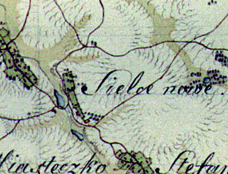
Stefanówek
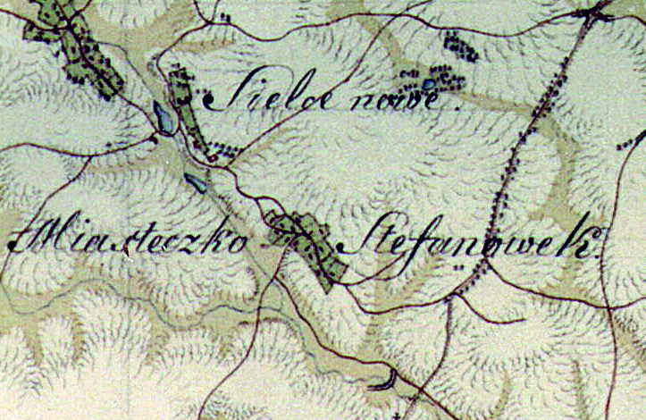 A small village located 4 kilometers from Staszów. It was known as "Stefanów" during its early days. Mentioned as a town in the 1674 registry; Stefanówek was a property of Dębicki family and was called "Bugaj" at the time. In latter written sources, it is consistently stated as a village.
During the 1975-1998 period Stefanówek belonged to Tarnobrzeskie Province. Records from 1827 list 15 households and 104 residents.
.
-
Sztombergi
 A village which used to belong to the Commune of Wiśniowa. Its name most likely comes from the family name of count Kołłątaj Sztomberg. In the 19th century, Sztombergi had 32 households and 148 villagers. In 1929 those numbers had increased to 38 houses and 230 people.
By the end of 1999 there were 239 people residing in Sztombergi, in 2006 – 285 residents, in 2012 – 313 residents, and by the end of 2015 there were 299 people living there.
-
Wiązownica Duża
Wiązownica Duża ("Large Wiązownica") is a rather populous village in the Municipality of Staszów. It lies 14 kilometres east of Staszów. Wiązownica belonged to the Commune of Osiek in years 1867-1954; during that period, it was divided into several colonies. It was annexed into the newly-formed Municipality of Staszów on January 1st 1973.
Wiązownica Duża has its elementary school, kindergarten and a bakery. The Kacanka river passes through the village.
-
Wiązownica Kolonia
 A village that lies approximately 17 kilometres east of Staszów. Wiązownica Kolonia ("Wiązownica Colony") has its own parish, dedicated to Archangel Michael. The village belonged to the Commune of Osiek in years 1867-1954 and was annexed into the Municipality of Staszów on January 1st 1973. Wiązownica Kolonia belonged to Wiązownica until 1954.
There is a church in Wiązownica Kolonia which was built in 1884, replacing the old 15th-century church which burned down in 1820. Under Russian annexation, local goods were seized by the invaders. Tsarist general Vasily Pogodin became new owner of Wiązownica Kolonia in 1835. Despite the circumstances, General Pogodin turned out to be a good host. In his expansive estate he built a palace, established a sophisticated homestead, and even financially supported the construction of a church.
-
Wiązownica Mała
 A small village which lies approximately 15 kilometres east of Staszów. In the years 1975-1998 it belonged to Tarnobrzeskie Province, then it was part of Commune of Osiek in years 1867-1954 and finally was annexed into the Municipality of Staszów on January 1st 1973. Wiązownica Mała ("Little Wiązownica") is another former colony of Wiązownica.
There are two old graveyards in Wiązownica Mała, both of them more than 150 years old, and a chapel built in 1910, in a style referencing the Neo-Gothic architectural movement.
-
Wiśniowa
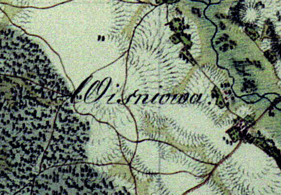 The village of Wiśniowa appears in historic documents as early as the 15th century, when it was simply called Stara Wieś ("Old Village"). Its current name likely comes from the abundance of cherry trees growing all around the village ("wiśnia" means "cherry" in Polish).
Many noble houses were involved in Wiśniowa's history, including Bogoria, Rytwiański, Łaski, Tarło, Kołłątaj families. Kasper Dymitrowski bought Wiśniowa off the Łaski family in the second half of the 16th century. Dymitrowski's son, Jan, built a wooden manor house in 1578. The Tarło noble family took over Wiśniowa after Dymitrowski family.
-
Wiśniowa Poduchowna
 Wiśniowa Poduchowna (roughly translates as "Wiśniowa of the clergy") is a rather old village, located in the Municipality of Staszów, right next to its twin village, Wiśniowa. The local parish church was built by count Karol Tarło in 1680, and ceremoniously consecrated by bishop of Kraków Mikołaj Oborski on 15th of November 1681. The heart of Hugo Kołłątaj rests in this church, beneath a memorial plaque.
By the end of 1999 there were 291 people residing in Wiśniowa Poduchowna, in 2006 – 318 residents, in 2012 – 314 residents, and by the end of 2015 there were 314 people living there.
-
Wola Osowa
 Wola Osowa is a village that lies approximately 8 kilometers north-west of Staszów. It is located at the province road number 764, leading from Staszów to Kielce through Daleszyce. Chańcza Bay is located close by the village.
By the end of 1999 there were 279 people residing in Wola Osowa, in 2006 – 290 residents, in 2012 – 291 residents, and by the end of 2015 there were 294 people living there.
-
Wola Wiśniowska
 Wola Wiśniowska is a village located about 14 kilometers to the east of Staszów. During the years 1975-1998 Wola Wiśniowska was a part of former Tarnobrzeskie Province.
This village has always belonged to the parish of Wiśniowa, whose main church is located in nearby Wiśniowa Poduchowna.
Wola Wiśniowska has a beautiful lake – Jasne – surrounded by lush forests rich in mushrooms.
-
Wólka Żabna
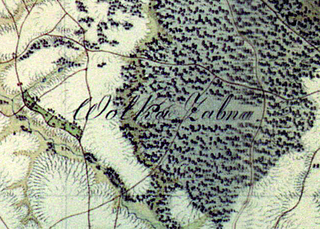 A small village located approximately 5 kilometers north-west of Staszów, surrounded by forests.
The locals earn their living primarily through farming locally; some of them are also employed in Staszów, in various trades.
By the end of 1999 there were 144 people residing in Wólka Żabna, in 2006 – 117 residents, in 2012 – 133 residents, and by the end of 2015 there were 130 people living there.
.
-
Zagrody
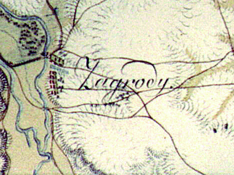 A small village in the Municipality of Staszów, located right next to Kurozwęki.
In ages past, Zagrody had a water mill (its now-defunct building still stands), oil factory and a tavern. During the 19th century there were two water mills here: one built in an American style, the other one in Dutch style, with 4 millstones; a mill for gypsum; and a sawmill. Records from 1827 list 10 houses and 59 residents in Zagrody. Currently there is a small but functional hydroelectric power station in the village, built at the river which used to support a water mill in the past.
-
Ziemblice
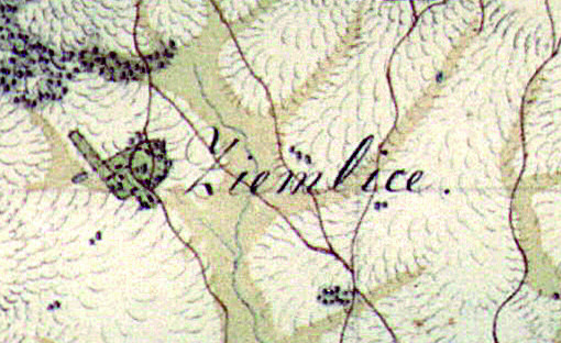 Ziemblice is a small village in the Municipality of Staszów; it lies approximately 5 kilometers west of Staszów.
According to surviving historic records about the region, in 1827 Ziemblice had 10 households and 70 residents. During the years 1975-1998 Ziemblice was a part of former Tarnobrzeskie Province.